The Ethur tribe

The Ethur, also called Jo’Abwor, are a tribe in North eastern Uganda. The Ethur belong to the Nilotic ethnic group under the Luo subgroup. They originated from Bar-el Gazel in South Sudan and moved south to Northern Uganda during the 15th century Luo migration. Upon reaching Northern Uganda, they settled at Labwor hills in present-day Abim district. They are culturally connected to the Acholi tribe.


The Ethur belong to Thur region (part of Karamoja region) and are governed in a clan system.
The Ethur are agricultural people but also keep some cattle. They farm millet, sorghum, maize, sweet potatoes, upland rice, pigeon peas, groundnuts, sunflower, and vegetables. Their staple food is Millet, Sorghum and Maize. Millet is called “Kal”, Sorghum – “Abir”, Maize – “Onywagi”. From millet or sorghum flour, bread is made. From maize, a drink called “Kwete” is made.
The Ethur dress code is animal skin and a maasai shuka.
 
The Ethur dance is called “Myel bul” dance (drum dance). Myel bul dance is a celebration dance that involves men playing drums like those played by the Acholi, and women forming a circle around the drummers. Men dress in animal skin, like Acholi, and women dress in a maasai shuka like the Karimojong.
 
The Ethur language is called “Leb Thur”.
 
The Ethur are the guardians and custodians of the “Switzerland of Karamoja” – Abim district. Abim district, unlike other semi-arid districts in Karamoja region, is well watered and good for agriculture. It’s hilly landscape and green vegetation comprised of tall grass and forest, is the reason Abim is sometimes called the “Switzerland of Karamoja”. The Ethur are the guardians and custodians of Labwor hills, the most popular hills in Abim district (Thur region). These hills, together with Rwoth and Akur hills, define the beautiful hilly landscape of Abim. Labwor hills are also the defining geographical feature of the Ethur tribe since it’s where they settled after their migration from South Sudan.
 
There are 98,348 Ethur (2014 census) in Uganda. The Ethur are mainly found in Abim district.

The Mvuba tribe

The Mvuba are a tribe in western Uganda in the northern foothills of the Rwenzori Mountains, on Uganda’s border with DR Congo.
The Mvuba belong to the Nilotic ethnic group. They are part of the larger Mvuba people living in Uganda and DR Congo who are said to have migrated from Sudan and travelled south-west to present-day DR Congo. In DR Congo, they are among the indigenous communities; in the same category as the Batwa.
 
It’s said that in the 1800s, a certain Belgian in DR Congo was moving along the Semliki River with his dog. While his dog was drinking from Semliki River, it was attacked and captured by a crocodile in Semliki River. The Belgian retaliated by pouring poison in Semliki River to kill the crocodiles. This poison ended up also killing fish. After this incident, communities around Semliki River found a lot of fish dead on the river and it’s banks. The community saw it as a good opportunity to get fish. This fish ended up causing deaths to the community members who had eaten it; everyone who would eat that fish would die in their sleep. The communities did not know what was causing the deaths. So they referred to the disease/cause of the deaths as “Sleeping sickness”. These communities were composed of people from either side of Semliki River: Uganda and DR Congo. One of the communities that got affected in DR Congo were the Mvuba people. As a result, some of the Mvuba in DR Congo migrated to Uganda in search of better healthcare and relief causing some to settle in Uganda.
 
It’s these Mvuba who settled in Uganda that became the Mvuba tribe. In Uganda, the Mvuba settled among the Vonoma, Baamba, Babwisi, and Batwa tribes in present-day Bundibugyo district. Because the Vonoma in Bundibugyo had also come from DR Congo (due to forced labour in DR Congo by Belgian colonialists), the Mvuba integrated within the Vonoma, who were living with Baamba, Babwisi, and Batwa tribes.
 
The Mvuba, together with the Vonoma, Baamba, and Babwisi, belong to Bwamba region led by an Omudhingiya (King). The current Omudhingiya is: Omudhingiya Martin Kamya Ayongi. The Mvuba are both agricultural and fishing people. They farm yams, cassava, groundnuts and vegetables. Their staple food is Yams and Cassava. From cassava flour, cassava bread is made. These foods are eaten with beans, groundnuts and fish. The fish is obtained from Semliki River. The Mvuba dress code is traditionally animal skin. Their modern dress code involves Kitenge (from DR Congo).
 
The Mvuba language is called “Mvuba”.
The Mvuba, together with Vonoma, Baamba, and Babwisi, are the guardians and custodians of Bundibugyo district – Uganda’s Cocoa Capital. More than 70% of the 26,000 tonnes of cocoa exported by Uganda annually are produced in Bundibugyo (Baamba/Babwisi/Vonoma/Batwa/Mvuba region). 85% of Bundibugyo is covered by cocoa farms. Bundibugyo cocoa is one of the finest organic cocoa worldwide and it’s behind a number of international chocolate brands.
 
The Mvuba, together with Vonoma, Baamba, Babwisi, Bakonzo, Batwa and Batuku, are the guardians and custodians of the Ugandan side of Semliki River. Semliki River is 140 km long, and it flows from Lake Edward to Lake Albert. It flows within the Albertine Rift west of the Rwenzori Mountains. As it traverses north from Lake Edward to Lake Albert, Semliki River meanders passing through DR Congo and later forming part of the international border between DR Congo and Uganda via Bundibugyo district. The river is a source of fish for the neighboring communities. It’s also a source of water for communities, wildlife, and cattle. The banks of the river are a fantastic place for camping, birding, and fishing. Tiger fish are one of the fish species in Semliki River.
 
The Mvuba, together with Vonoma, Baamba, Babwisi, Batwa, and Batuku, are the guardians and custodians of Semliki Forest. Semliki Forest is one of Africa’s most ancient and bio-diverse forests. It’s one of the few forests that survived the last ice age (12-18,000 years ago). Semliki Forest stretches from DR Congo, where it’s called Ituri Forest, to Uganda’s Semuliki National Park in Bundibugyo (Baamba/Babwisi/Vonoma/Batwa/Mvuba region), and Ntoroko (Batuku region). Semliki Forest is home to a number of wildlife including primates, elephants, buffaloes, antelopes, and birds. Some of that wildlife is Central African in nature; which makes Semliki forest the best place to experience Central African wildlife while in Uganda.
 
The Mvuba, together with Vonoma, Baamba, Babwisi, and Batwa, are the guardians and custodians of Semuliki National park, home to the famous Sempaya hot springs – Uganda’s most popular hot springs. Sempaya hot springs are composed of two hot springs: a “male” and a “female”. The male hot spring is called “Bintente”. It measures 12m in diameter and it’s set in a lush swampy clearing. The female hot spring, called “Nyasimbi”, is a boiling geyser; boiling at 103°C while spurting bubbling water and steam that rises up to two meters high. These hot springs are a popular tourism attraction.
 
The Mvuba are Uganda’s 3rd smallest tribe. The Vonoma tribe are the smallest followed by the Mening tribe. The Bahehe tribe are the fourth smallest after the Mvuba.
 
There are 2,879 Mvuba (2014 census) in Uganda. The Mvuba are mainly found in Bundibugyo district.

The Banyarwanda tribe

The Banyarwanda are a tribe in western, central and southern Uganda.
 
The Banyarwanda are a mixture of Bantu and Nilotic/Nilo-hamitic ethnic groups. They are part of the larger Banyarwanda people living in Uganda, Rwanda, Burundi, DR Congo, and Kenya. The Bantu, Hutu, originated from central Africa during the 11th century Bantu migrations and settled in present-day Rwanda, South-western Uganda, and parts of eastern DR. Congo. The Nilotic/Nilo-hamitic, Tutsi, are said to have originated from Ethiopia and settled in different parts of East Africa.
 
The Hutu and Tutsi that settled in present-day Rwanda became the Banyarwanda people: “People of Rwanda”.
In 1910, during the German colonial rule in Rwanda, the boundary of Uganda and Rwanda was changed making the Rwandans who were on the new Uganda side, automatically Ugandans. Between 1910 and the period of Second World War (early 1940s), many Rwandans migrated from Rwanda to Uganda to work in Uganda’s cotton, coffee, and sugar plantations. Some of them left Rwanda because of the harsh taxation and labour policies that were imposed by the Belgian colonialists in Rwanda.
 
Between 1959 and 1994, more Rwandans moved to Uganda due to the ethnic conflicts that were in Rwanda. Some of the Rwanda-originating people like the Bafumbira, and the Batwa (who came from Rwanda), became independent tribes in Uganda – Bafumbira tribe and Batwa tribe respectively. The rest of the Rwandans (Banyarwanda) who settled in Uganda, became the Banyarwanda tribe.
The Banyarwanda in Uganda adopted some cultures of the other Ugandan tribes. The Ugandan Banyarwanda are an egalitarian society without a general cultural leader. Much of the tribe leadership is at family level.
The Banyarwanda are pastoral and agricultural people. They keep cattle and also farm millet, cassava, maize, and vegetables. Their staple food is Millet, Cassava and Milk. Millet is called “Uburo”, Cassava – “Umwumbati “, Milk – “Amata”. From millet or cassava flour, bread is made. Cassava can also be boiled fresh. This bread, and boiled cassava are eaten with “Ibihyimbo” (beans), milk, and milk products. Their traditional drinks are: Milk, and Urwagwa, a drink made out of bananas.
 
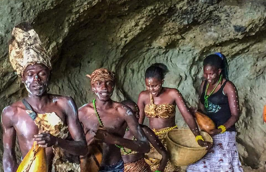
The Banyarwanda dress code involves men wearing a shirt and trouser with a drape tied diagonally at the shoulder, and hold a walking staff. Women wear Umushanana, a dress or skirt with an over-the-shoulder drape. The Banyarwanda have a number of dances among which include: Amaraba dance and Intore dance. Amaraba dance and Intore dance are celebration dances. Amaraba dance is a women dance while Intore dance is a warrior dance.


The Banyarwanda language is called “Runyarwanda”. It’s the same as Kinyarwanda spoken by Banyarwanda in Rwanda.
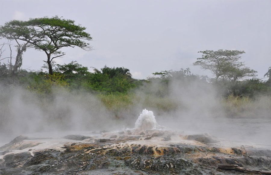
The Banyarwanda, together with the Bakiga, Bafumbira, Banyankole, Bahororo, Batooro and other western Uganda tribes, are the guardians of the beautiful western Uganda, home to wonderful landscapes, forests, lakes and wildlife. Western Uganda is also the home of the famous Ankole cattle.
 
The Banyarwanda, together with the Baganda and other tribes in central Uganda, are the guardians of the beautiful central and southern Uganda, home to Uganda’s capital city, Lake Victoria, forests, and wildlife.
There are 524,098 Banyarwanda (2014 census) in Uganda. The Banyarwanda are mainly found in Kisoro, Kabale, Rukungiri, Ntungamo, Bushenyi, Isingiro, Mbarara, Kabarole, Rakai, Masaka, Kiboga, Kyankwanzi, Luwero, Mubende, Nakasongola, and Kampala districts.


The So tribe

The So, also called Tepeth, are a tribe in North-eastern Uganda on the slopes of Mount Moroto.
 
The So belong to the Nilotic ethnic group. They are said to have inhabited Moroto region earlier than the 17th century migration of the Karimojong tribe who migrated from Ethiopia to North-eastern Uganda. The Karimojong migration, and the conflicts with rival tribes caused the So to migrate to the slopes of Mount Moroto. The So belong to Tepeth region (part of Karamoja region) and are governed in a clan system composed of clan elders and opinion leaders.
 
The So are pastoral people but also do agriculture. They keep livestock mainly short horned cattle, and farm sorghum, maize, and beans. Their staple food is Sorghum and Maize.
 
The So traditional dress code is a Maasai shuka and beads jewelry. Men dress in a Maasai shuka either tied diagonally from their shoulder, or in form of a skirt. Women dress in a Maasai shuka skirt with a beads belt. Women wear a series of bangles, necklaces, bracelets and headbands made out of beads.
The So language is called “Tepes”.
The So dance involves men and women making a series of short veticle jumps made without the feet leaving the ground. These jumps are accompanied by whistling and shouts made by the dancers. In the dance, men and women are organized in separate horizontal lines facing each other so that one men are directly facing women. The women eventually turn around and face the same direction as men.
 
The So are known for their hair cut which leaves horizontal lines of hair in the middle of the head.
The So, together with the Matheniko community, are the guardians and custodians of Mount Moroto, the highest mountain in North Eastern Uganda measuring 3,083 m high.
 
They are also the guardians and custodians of Mount Moroto Forest Reserve, a 480 sq Km forest that stretches from the east of Moroto town to the Uganda-Kenya border. Mount Moroto Forest Reserve is home to 220 recorded birds species and 200 tree and shrub species. Some of the bird species in this forest reserve, like the Hemprich’s hornbill, Pink-breasted lark, Three-streaked tchagra, Buff-crested bustard, and Yellow-vented eremomela, are not found elsewhere in Uganda.
 
There are 23,422 So (2014 census) in Uganda. The So are mainly found in Moroto district.

The Sabiny tribe

The Sabiny, also called Sebei, are a tribe in Eastern Uganda on the northern, and north-western slopes of Mount Elgon on the border of Uganda and Kenya.
 
The Sabiny belong to the Nilotic ethnic group. They are said to have migrated from Israel to Egypt, moving southward through Ethiopia and Sudan and finally settling in Uganda and Kenya. They are believed to be descendants of the lost tribes of Israel. In Egypt, they were guards of Pharaoh. The Sabiny belong to Sebei region and are governed in a clan system.
 
The Sabiny are agricultural people. They farm millet, sorghum, bananas, sweet potatoes, maize, cassava, groundnuts, simsim, vegetables and coffee. Their staple food is bananas and maize. They use maize flour to make Posho (maize bread).
Kupsabiny is the language spoken by the Sabiny. It’s a Kalenjin language of the Kalenjin people in Eastern Uganda and Kenya.
The Sabiny are the guardians and custodians of Sipi Falls, a beautiful and magnificent waterfall on the northern slopes on Mount Elgon. Sipi Falls is located in Kapchorwa (Sebei region). It’s among Uganda’s most popular waterfalls and it’s the most popular waterfall in Eastern Uganda.
Joshua Cheptegei
sabiny-3
The Sabiny are the guardians and custodians of Uganda’s and East Africa’s Abseiling Experience. Sipi Falls Abseiling is the only Abseiling experience in Uganda and East Africa. It’s a two-hour activity that allows you to drop 100 m over the rock edge of Sipi Falls before dipping into a pool at the bottom. The Abseiling activity was founded by Robert Cheptoek, a Sabiny, in 1999. His company, Robs Rolling Rock, manages the activity. Visitors can also climb rocks at the bottom of Sipi Falls.
 
The Sabiny are the guardians of Uganda’s most popular coffee tourism experiences. Just like the Bagisu, the Sabiny also grow Arabica coffee on the slopes of Mount Elgon. Tourists visiting Sipi Falls are often treated to coffee tourism experiences in Kapchorwa (Sabiny region). The landscape in Sebei region is wonderful and offers great views of plains and distant vegetation.
The Sabiny are the guardians of Uganda’s World class marathon athletes and athletics. Three World marathon gold champions are Sabiny including a number of silver and bronze champions. The gold medalists include: Moses Kipsiro, Stephen Kiprotich, Joshua Cheptegei.
 
Moses Kipsiro: Gold medalist – 10,000m, 2006 African Championships in Athletics. Gold medalist – 5,000m, 2010 Commonwealth Games New Delhi, India. Gold medalist – 10,000m, 2014 Commonwealth Games Glasgow, Scotland.
Stephen Kiprotich: Gold medalist, 2012 London Olympics men’s marathon.
Joshua Cheptegei: Gold medalist, 2019 IAAF World Athletics Championship Doha, Qatar.
There are 273,839 Sabiny (2014 census) in Uganda. The Sabiny are mainly found in Kapchorwa, Bukwo, and Kween districts.

< 1 | 2 | 3 | 4 | 5 | 6 | 7 | 8| 9>

Follow, Like, and Join us on Social Media

error: Content is protected !!